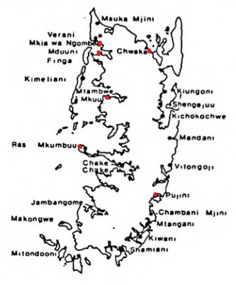
Map of the Archaeological sites on Pemba.
Hadra (Pemba)
------------------
The first author to mention Pemba was Al Jahiz (869) by speaking about Qanbuluh (= Ras Mkumbuu on Pemba); Al-Mas'udi (916) is the second (Qanbalu). He also mentions that the island has been concurred by the Muslims around the time of the Abbasids taking power; the third Buzurg (955).
Yakut (1220) is the first one to mention the island as al-Khadra and two places Mtambwe Kuu, and Mkanbalu. And
that they each have a sultan. It comes as no surprise that the island is completely Islamic when the Portuguese arrive and that it has than five sultans. Forming the hinterland of the coastal
cities for trading. Al-Saghani (1252): Al Khadra.
Buzurg ibn Shahriyar (955) mentions in Sailors tale 120 a place 'Thabia' according to Freeman-Grenville Thabia is situated on Pemba. He says; it can plausible be identified with the present Mtambwe, also on Pemba island, through there is no known trace of antiquities.
Taken from: The Swahili World edited by Stephanie Wynne-Jones, Adria LaViolette.
Chapter: Pemba Island circa 1000-1500 ce by Adria LaViolette.
Pemba Island was a Swahili heartland from the mid-first millennium CE. Early success was based on mixed agricultural/fishing villages, among which Tumbe (only 50meters away from Chwaka) emerged to prominence on Pemba in the late first-millennium coast (Fleisher and LaViolette 2013; Fleisher, “Tumbe’). In the early second millennium, we see a shift to stonetown polities, absorbing a large proportion of rural dwellers into their growth (Fleisher 2010a, ‘Town’). This urbanisation aligns with broader coastal transformations yet was particularly vibrant here until the sixteenth century. In the fourteenth-fifteenth centuries, for example, some 15 contemporaneous settlements with stone architecture ringed the island; many were smaller earth-and-thatch settlements with a single stone mosque or tomb. At least five settlements were larger, with stone houses, mosques and tombs plus numerous earth and timber structures — Mtambwe Mkuu, Ras Mkumbuu, Chwaka, Pujini, Mkia wa Ngombe, (and nearby Mduuni) - but many of the smaller settlements with even one stone building were around for many centuries, not to mention all the village settlements. The diversity and density of settlements suggests that Pemba participated in rich social, religious and economic relationships, both intra-island and in the larger coastal and Indian Ocean world.
Mtambwe Mkuu

Mtambwe Mkuu sits near modern Wete on a small islet. It was founded in the ninth century by people using ETT/TIW and other Early Iron Age ceramics (Horton and Clark 1985), grew into a 16 ha settlement of c 1,000 people, and was abandoned in the fifteenth century. Soon after Mtambwe’s founding, a timber hall was built on the plateau, then rebuilt in stone in the tenth century (Horton in press). Also on the plateau is a sequence of at least two stone mosques and remains of some eight other buildings. Twenty burials of men, women and children spanning 1000-1150 CE likely represent a family cemetery, with suggestions of early Sunni/Ibadi and later Shi'ite burial practice. A single stone tomb held a mature female skeleton (Horton in press).
The domestic sector revealed evidence of shoreline management as early as the twelfth century, including a line of mangrove stakes to control erosion behind which a midden accumulated.
The important Mtambwe coin hoard (Horton et al. 1986) came from a pit in the corner of a modest earthen house: 630 locally minted silver coins (Pallaver), and 8 gold coins 7 Fatimid and one Abbasid dinars, the latest dating to 1066. They show Pemba's economic ties to the region notably in the absence of stone dwellings, the gold coins were struck in cities all around the Mediterranean in the contemporary nations of Egypt, Tunisia, Syria, and Lebanon.
Each silver coin had a name on one side and a spiritual maxim on the other. The coins from Kilwa, have a design resembling this one. The names of the rulers on the coins match those in the Kilwa Chronicle. The two economies were connected and coins from the Mtambwe series were also discovered in Kilwa. (La Violette)
Associated indigo-dyed cloth and a silver clasp suggest the coins’ burial in a bag (Horton ef al. 1986). The fabric leads us back to the plateau where, in addition to mosques, cemetery and non-domestic buildings, lime-lined pits could indicate indigo dyeing, leather tanning or both (Horton in press; LaViolette).

Part of the Mtambwe hoard at a scale of 150%.
Picture from:
The Mtambwe Hoard; M. C. Horton, H. M. Brown & W. A. Oddy in Azania: Volume 21, 1986 - Issue 1

All evidence attests to a well-off town from its founding onward, with certain finds revealing particular points of contact. Red-painted and graphited earthenware found at Mtambwe is virtually identical to vessels found in several distant locales. On Pemba, robust assemblages of these ceramics were found at Bandarikuu (Fleisher), while smaller numbers are found at other similarly dated sites such as Shanga (Horton 1996). More notably, eleventh-twelfth-century Sharma, Yemen, thought to be a transit point for sailors (for example, Rougelle 2004; Beaujard, this volume), yielded developed Tana Tradition pottery including red-painted/graphited ware, suggesting the possibility that Pemba was the bowls’ source and possibly that Pembans themselves were in Sharma, in transit while engaging in Indian Ocean trade. There are significant amounts of it in multiple contexts in the Comoros (for example, Wright 1992; Vérin 1986), once considered its source. Beaujard notes that graphite is available on Madagascar and on the eastern African mainland but not in the Comoros, raising questions about this region as the source of the pottery, and begging the question of whether it all originated on Pemba (Horton in press). Additionally, chlorite-schist and rock crystal found at Mtambwe point to exchange connections with Madagascar (Horton in press).
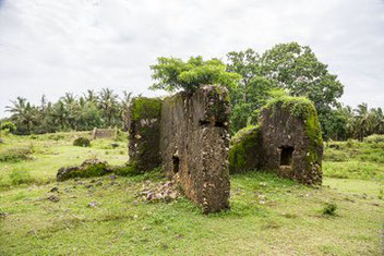
Ras Mkumbuu


Left plan of the Ndagoni ruins. Right: in front the pillar tomb T4; behind T3 (small); then further back T2 (even smaller); T1 pillar Tomb and in the background the ruins of the Mosque.
Ras Mkumbuu sits at the end of a peninsula reaching westward from central Pemba, near Chake Chake. It had two settlement phases: tenth-twelfth-century, over 6 hectares on a low (15 m) plateau; and fourteenth-sixteenth-century, 10 hectares by the shore (Horton in press). There were two working harbors. Despite a sparse historical record related to Pemba, there are tantalizing mentions in early documents that probably refer to the island. Most famously, al-Mas’udi visited a place in 916 CE called Qanbalu, where he noted a Muslim ruling family and townspeople, and that the place was able to trade for goods such as ivory and gold from the African interior (Freeman Grenville 1962: 14-17). Qanbalu has been linked to the entire island of Pemba (for example, Trimingham 1975: 122 ff; Horton and Middleton 2000: 66; Wood), but also to Ras Mkumbuu specifically (Kirkman 1959), and writers continued to mention Qanbalu into the thirteenth century (LaViolette and Fleisher 2009).
Kirkman’s (1959) work here was inspired by this reference, although he never found the early deposits; Horton (in press) located the early phase in 1991.
In that early phase, represented by building mounds and abundant domestic deposits, Horton documented a series of timber buildings with clay floors, hearths and associated middens (including a Muslim burial); a stone mosque sequence, suggesting the site was founded by Muslims; and another stone building. The mosque originated in the tenth century as a timber structure which burned and was rebuilt in Porites-coral later that century. Horton (in press) suggests its proportions, similar to those at Sanje ya Kati (Pradines 2009), may indicate Ibadi practice (echoing hints at Mtambwe and Chwaka). In the early eleventh century a third, larger mosque was built on the same spot. In the twelfth—-thirteenth centuries this mosque (and part of town) was used only as a cemetery; Horton (in press) located 15 Muslim graves.
Early earth and timber houses were rebuilt in coral with bonded mud by the eleventh century. At its most impressive, there were some 15 stone-built houses and at least 14 tombs, 6 of which were pillar tombs, dating to the fourteenth century or later (see Horton, ‘Islamic Architecture’). A mosque wall bears ship graffiti, as seen elsewhere on the coast (Garlake and Garlake 1964; Horton and Clark 1985; Gilbert).
Ras Mkumbuu’s numerous stone houses suggest it was an important merchant town as well as prominent in other ways, and the range of materials excavated confirms broad trade connections. Virtually overlapping in time with Mtambwe, and also on the west coast of the island, local earthenwares from the two sites differ; there is no ETT/TIW and no significant quantity of Sasanian-Islamic or white-glazed pottery with Persian Gulf origins at Ras Mkumbuu (as seen at Tumbe, for example; Fleisher). Whereas timber and earth houses at Mtambwe yielded that significant presence of red painted/graphited wares, there are virtually none from Mkumbuu.
These differences do not point to the particular northern connections Mtambwe clearly had, or to the link with the Comoros.
Chwaka

14th century mosque at Chwaka, Photo by M. Horton.
Chwaka 13-14th century mosque foto Horton.

13th – 14th century Persian Gulf and Chinese ceramics, Chwaka. Photo by A. LaViolette.

In circa 1050 CE, settlers came to the recently abandoned site of Tumbe in northeast Pemba, moved past its eastern edge about 50 m, and founded Chwaka. Within a century it covered 8 ha; by 1300 it measured 12 ha where it remained until abandonment in the early sixteenth century. Chwaka comprised densely packed earthen houses, stone mosques and tombs, and a stone house. This elevated, breezy spot with a view of Micheweni Bay and peninsula attracted additional settlers to it after Chwaka’s abandonment; a portion of Tumbe was reoccupied in the eighteenth century by Mazrui Arabs from Mombasa, who built a small fort (similar to that in Chake Chake; LaViolette et al. 2008).
Research at Chwaka located earthen houses in stratified series along with neighborhood middens. All evidence indicates a well-to-do town, consuming an abundance of local and imported goods — ceramics, beads, metal tools and personal items — throughout its history. In addition to extensive other subsistence information, houses provided evidence for a local millet-based diet transitioning to one based on Asian rice in the late first millennium (Walshaw 2010). There was also a striking increase in the importation of large bowls, presumably for food presentation, in the early first millennium, and also local production away from small bowls toward larger bowls and platters.
These changes, plus faunal evidence for feasting, has led Fleisher (2010b) to argue that on Pemba and elsewhere on the coast there was an increasingly competitive atmosphere among polities in the fourteenth—fifteenth centuries, such that competitive feasting was a way to enhance the reputation of leaders. Material from the houses and middens also included production materials for pottery, cloth and iron.
Four stone-built mosques index socio-economic and cultural transformations at a settlement where nearly everyone lived in timber and earth houses. A first mosque made entirely of Porites reef coral was erected in the eleventh century in the middle of town, echoing the pattern at Ras Mkumbuu and other early second-millennium settlements on the coast (Horton, ‘Islamic Architecture’). It is stratified below the standing ruins of a later mosque (Horton 2004). A second mosque was built in the thirteenth century (with the first probably still in use), at the north edge of the bluff, echoing a trend on the coast at that time for siting mosques near the water’s edge, providing intervisibility with approaching vessels (Fleisher et af. 2015). A rear hall with a small window into the main hall may be a women’s room, suggesting adoption of changing norms elsewhere in the Muslim world and seen also at Ras Mkumbuu (LaViolette et al. 2014; Horton in press). Among related finds included a crushed ostrich eggshell, which probably once hung from the mihrab as they still do on Pemba and elsewhere. In the fourteenth century the first mosque was razed and over it built a spectacular congregation mosque in coral rag with Porites details. This new larger structure was later, further enlarged with two side halls, tripling its capacity, speaking to population growth but also to growing community wealth and standards (Fleisher 2010a). While the earlier mosques had timber/mortar roofs, the congregational mosque’s roof comprised six mortared limestone cupolas and two barrel vaults. The mihrab, one of the most decorated on Pemba and among the most extraordinary on the coast, bore multiple registers of herringbone decorations, inset Chinese bowls and plaster rosettes
(Pearce 1920; Garlake 1966). Stone tombs sit just north, signaling a large, central precinct flanked by the two mosques, and a relatively simple stone house sits close by. Finally, with the second and third still standing, a fourth, small mosque was constructed in the fifteenth century, which oral traditions say commemorated a deceased ruler. It was largely intact a century ago, and is notable for its elaborate cupolas which have now fallen.
Chwaka’s residents invested heavily in spiritual life, expanding their architectural offerings to absorb their population with bigger and better structures and amenities in a town with modest domestic spaces. The presence of high-ranking merchants might be questioned, but the full range of goods was flowing into the town. Evidence for specific networks is found in the form of the architecture. The roof of the congregational mosque directly echoes designs at Kilwa to the south (Wynne-Jones), and was outstanding not only on the island but on the coast, signalling a local consciousness about participating in that larger world.
Pujini
The fifteenth—sixteenth-century citadel of Pujini sits on Pemba’s central/southwest coast. Its defining feature is a rectangular stone rampart surrounding 1.5 ha of open space and structures, including a multi-storied house built in classic fourteenth—fifteenth-century Swahili style (Gensheimer). Nearby are deposits containing a stone mosque and two wells, and small village mound likely contemporary with the settlement. We recovered ETT/TIW from the mosque area and at spots beneath the main site.

The rampart comprises three parallel walls and supported a parapet walk (Pearce 1920). Some, perhaps all, of the space within those walls was divided into rooms. This configuration is a larger version of the fourteenth-century southern courtyard at Husuni Kubwa, Kilwa (Chittick 1963), and probably modeled after it as the only comparable structure on the coast. There were gates through the rampart, west and east. Immediately inside that gate were plaster-floored rooms. An inside staircase reached up to the parapet, opposite which a ladder on the outside would have allowed unloading of goods. Pujini appears to have been built to impress and defend like a small fort.
The principal house included a large zidaka (see Gensheimer, Meier, Sheriff) that once boasted Chinese bowls; doorways surrounded by carved Porites and plaster decorations; and a dhow graffito. There are a few simpler stone houses and guest quarters with a toilet/bathing area near the western gate. There are work, storage and decorative spaces, including another dhow inscription. In the northeast is a sub-surface shrine to land/sea spirits: open-air steps lead down into fossilised coral, to a small, once-domed room (Pearce [1920] 1967: 392ff; Horton and Clark 1985; Fleisher and LaViolette 2007), whose walls bear a molded siwa (Allen 1993), a ceremonial side-blown horn, like the fingo, associated with coastal — and inland — eastern African polities.
Deposits are dominated by locally made earthen-wares. Imports are mostly Chinese wares and Persian monochromes, copper-alloy items, glass vessels and beads, and rock crystal, possibly from Madagascar.


The large stone staircase that leads up to the rampart, which allows access to the place where the channel from sea reached the port for loading and unloading boats.
Mkia wa Ngombe
In the west of Pemba first settled in the 11th century; abandoned by the late 15th or early 16th century. Mkia wa Ngombe was a town of similar size to Chwaka.
Mkia wa Ngombe is now known to be approx. (A.D. 1050–1300) 8 ha; (AD 1300-1500) 18 ha. (cf. Horton and Clark 1985). It is likely that buried sectors represent non-elite areas and or earlier components. Mkia wa Ngombe and Mduuni face each other across an inlet, and comprise the only example on Pemba where two larger settlements lie in such proximity. Mkia wa Ngombe (among the five biggest towns on Pemba) contains one of the most extensive set of ruins on Pemba, including a large stone mosque, multiple tombs, and rubble indicating stone elite houses (Buchanan 1932: 18; Horton and Clark 1985: 23–25).

Taken from: Zanzibar Archaeological Survey 1984-5 by Kate Clark.
Ruins are found halfway down a narrow peninsula which juts out into a wide bay. They can be reached by a narrow path from Tondooni or more easily by boat. Buchanan (1933:18) describes these ruins as one of the most extensive areas on Pemba. Pearce called this place Kijeweni, but according to local people, this place is actually the adjacent peninsula.
The mosque:
A freestanding musulla contained nine pillars, although only four survive above ground. The south and east walls are indicated by rubble, but two arched doorways still survive in the west wall. These porities coral arches have a plain architrave with a nick at the apex. They face out onto 4 low veranda. The kibla has collapsed but seems to have been a simple pointed arch. West of the mosque there is a depression which may have been a well.
The tombs:
13 visible tombs remain around the mosque today, against an original total of at least 19 tombs, of which Buchanan described 17 (1933:19). Considerable robbing has taken place, but there were at least five pillar tombs here.
Houses:
Buchanao noted ruins 50 yards away from the mosque on the edge of the forest, but these have now been robbed. To the south of the mosque there is a low mound which may be a buried structure. To the east there are fragments of coral and rag lime walls located on a rubble mound, which were probably once a house. Excavation (NG1) was located 35m west of the mosque. 1.4m of occupation deposits were noted over a buried soil; the primary feature was a shallow U shaped gulley sealed by brown loams. The area seems to have been a succession of midden deposits interleved with sandy deposits. The upper levels contained a considerable quantity of animal bone. Imported pottery included Sgraffiatio wares and in the upper levels, green monochromes and one sherd of Black on Yellow pottery. Local pottery included types with punctate and incised lattice decoration as well as red burnished pieces. Occupation on the site in this area spans the twelfth to the fifteenth century A.D.
Taken from: Archaeological Survey and Excavations in Northern Pemba Island, Tanzania, 1999-2000 By Jeff Fleisher.
Mduuni
Mkia wa Ngombe and Mduuni face each other across an inlet, and comprise the only example on Pemba where two larger settlements lie in such proximity. Mduuni, was established around 12th century and abandoned in the 14th century. Mduuni was a smaller town and among a set of eight others of similar size and composition around the island.
Mduuni is now known to be approx. (A.D. 1050–1300) 4 ha; (AD 1300-1500) 7 ha. (cf. Horton and Clark 1985). It is likely that buried sectors represent non-elite areas and or earlier components. One small stone mosque and an extensive surface ceramic scatter mark the site of Mduuni, dating it to at least the 14th century (Horton and Clark 1985: 23).
Taken from: Zanzibar Archaeological Survey 1984-5 by Kate Clark.
Mduuni
The site, described by Buchanan (1933:21) can be reached by sea or from a path from the modern village of Mduuni. It is located on a peninsula comprising a flat plateau with a steep slope leading to a mangrove fringed beach. There was an Arab living here whose house was actually being robbed for building stone when we visited it. The place is known as Ukutani (or the place of the walls). Pearce called the site Chaoni after a more distant village.

The mosque is early in date and well preserved. The musulla is rectangular with four columns, The south east and eastern parts of the north wall survive and the structure was in much better condition in the 1930s. The mosque was entered only from the east where there were two doors, one of which lies adjacent to a square tank, The mihrab had a pointed arch which has now fallen. There is no well but a depression near the southeast corner of the mosque suggests its position.
The ruins:
40m west of the mosque lies a circular well surrounded by a mound of rubble. This must be the site of the two houses described by Buchanan which have been robbed. A stone inscription was found 100m north of the mosque by a farmer looking for building stone. This is now in Zanzibar museum.
Dating:
Large amounts of surface pottery were found along the beach 200 m north east of the mosque. These included monochrome wares and red burnished local pottery, as well as Sgraffiato, green Celadon and Martabani jars. The site seems to date to the fourteenth century.
Taken from: The Early Swahili Trade Village of Tumbe, Pemba Island, Tanzania, AD 600–950.
Article in Antiquity · December 2013 by Jeffrey Fleisher1 & Adria LaViolette.
Tumbe
Named after a modern village nearby, sits on a bluff overlooking Micheweni Bay with easy access to the sea, Pemba Channel and the mainland coast. Tumbe was abandoned in the mid tenth century and it is adjacent to the eleventh to sixteenth-century Swahili town of Chwaka.
Archaeological survey in northern Pemba (Fleisher 2003, 2010) indicates that for the years AD 600–1000, when Tumbe flourished, villages proliferated in the surrounding countryside. Some 15 sites with eighth–tenth century components were recorded, nine within 2km of Tumbe. The survey shows that settlements were particularly clustered around Tumbe itself. With villages likely acting as largely self-sufficient entities (Fleisher 2010).
The settlement landscape after AD 1000 was dramatically different, one in which new towns such as Chwaka were founded as villages in the countryside were largely abandoned, suggesting the movement of people from villages to emerging towns.
The locally produced pottery from Tumbe is part of the Early Tana Tradition (ETT, what Chami 1998 calls ‘TIW’), with incised and punctuated decorations most commonly found on medium- to large-sized necked jars. This pottery is the most common feature of regional coastal and hinterland sites from the sixth–tenth centuries, from northern Kenya to southern Mozambique and at interior settlements (Horton 1996; Chami 1998; Fleisher & Wynne-Jones 2011). The ETT is found at sites throughout northern Pemba (Fleisher 2003, 2010) and sites further south on the island (LaViolette & Fleisher 1995).

Among contemporary settlements, Tumbe has a high density of imported goods (Chami 1994; Horton 1996; Sinclair et al. 2012). Over 3000 imported sherds were excavated, with over 2000 dating to the earliest component, AD 600–950. They include many found at other sites: Sasanian-Islamic (blue-green glazed ware), white-glaze wares (plain/colour-splashed), lustre ware, Siraf storage jars (pale green/pink fabrics), fine creamwares and small numbers of Chinese stonewares (Du’sun jars) and greenwares (Yue). Over 2800 glass fragments were recovered, We recovered diverse copper items (n = 51) including earrings, rings and needles.

The inhabitants of Tumbe conducted small-scale bead and iron production in and near their houses, which likely exceeded local needs, especially in the case of beads. The engagement of Tumbe with the larger Indian Ocean world is attested by the sheer quantities of imported pottery, lead, glass and forms of adornment. The presence of such goods within the burned earth-and-thatch houses suggests they were fully integrated into quotidian practice. That imports were spread across the settlement indicates that the fruits of long-distance trade were not concentrated among only certain, elite portions of the population; the houses excavated were likely the standard form across the site. This is, again, consistent with Tumbe’s contemporaries, Manda (Horton 1986: 209) and Dembeni. (Wright 1984)